
Kamikochi autumn colour moves down the landscape rather than turning the whole valley at once. Early October can give coloured mountain slopes while the river corridor is still changing; middle October often brings the stronger broadleaf display; the Japanese larches can hold the golden scene into the latter part of the month. Decide which colour matters to you before choosing the date. For a first day, the pond-to-bridge walk remains a stronger plan than adding distance simply because the map offers it. For a short, transport-led visit, compare the Matsumoto day-trip route.
Transport is the other half of the date choice. On the Matsumoto side in 2026, a booked mountain-bus passenger has priority; an unbooked person boards only if a seat remains. An autumn Saturday needs a reserved departure in both directions if the rest of your trip depends on it. The railway from Matsumoto to Shin-Shimashima is a separate, unreserved leg.
↔ Scroll table left or right
Priority | Route or date to try first | What to allow for |
First day in the valley | Taisho Pond, Tashiro Pond, Kappa Bridge and terminal | Spend time at the scenery rather than using every hour on distance |
Red and orange trees | Use the usual middle-October window, then inspect current conditions | Busy buses and a cold front can shorten a strong display |
Golden larch | Look toward the later-October phase | Broadleaf colour may be thinning and mornings can be cold |
Young child, limited mobility or poor weather | Terminal and Kappa Bridge, with a short Tashiro extension if comfortable | Less ground covered, but food, toilets and buses remain close |
Myojin is important | Reach Kappa Bridge with around three usable hours left | About two hours of walking before any stop at Myojin |
Tokusawa, dawn or a second forecast chance | Consider an in-valley overnight | Higher room cost and meal times in exchange for a longer window |
Kappa Bridge is the useful midpoint of the day. Once there, compare remaining daylight, weather, the bus booking and any suitcase deadline before deciding whether Myojin still fits.
Maple red and larch gold belong to different weeks
The usual progression starts on higher slopes in late September. Valley trees develop during October, with red and orange broadleaf colour often stronger around the middle of the month. Larch yellow tends to follow, frequently about a week later. These are seasonal patterns, not promised peak dates; a cold spell or wind can change the scene quickly. The broader timing picture is in the Japan autumn colour calendar.
Use the date range to match the scene you want:
Early October suits travellers who already have fixed dates and want colour on higher slopes, though valley maples may still be developing.
Mid-October is the usual broadleaf target if red and orange tones matter most; demand is also high.
Late October favours golden larch even if some maples have lost their leaves.
Early November is late-autumn scenery, with bare branches and possible snow; do not treat it as an extension of October peak.
Recent local photographs are more useful than a generic foliage chart when departure is near. A dated report on October 23, 2026 described red and yellow foliage as reaching a strong stage, but its description is a snapshot, not a guarantee for next week. Check the forecast and current trail notices before committing to the longer walks. October 2026 site updates Photography choices after a cold front are covered in the autumn photography guide.
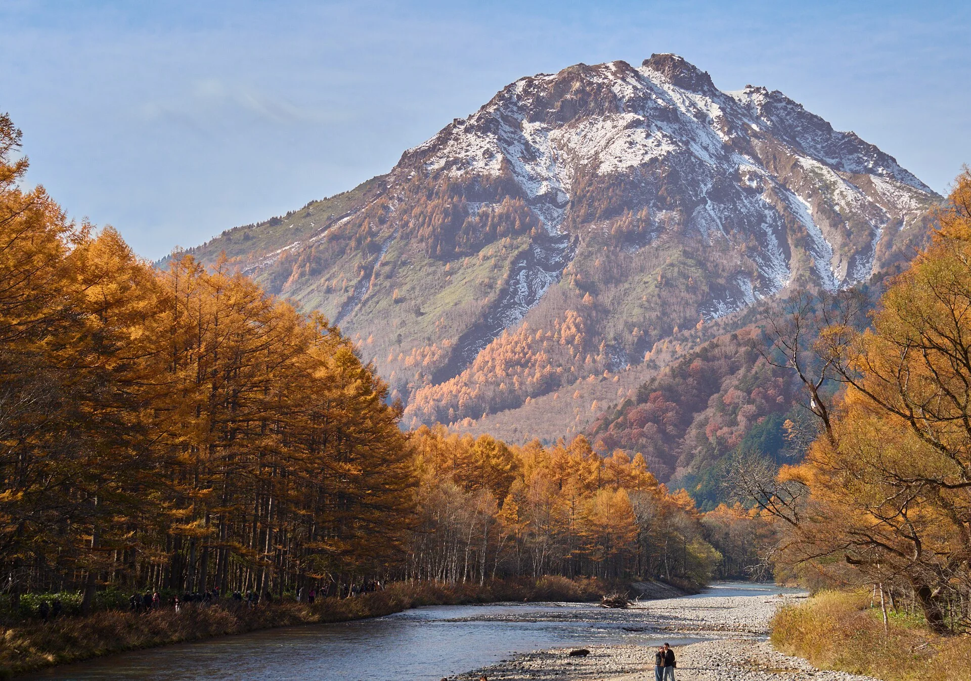
The Taisho Pond approach earns its place on a short visit
The mapped Taisho Pond–Kappa Bridge nature trail covers roughly four kilometres and about 75–80 minutes of movement, depending on bank. A route beginning at Taisho-ike Bus Stop, passing Tashiro Pond and Tashiro Bridge, then reaching the bridge and Bus Terminal takes about 70 minutes without pauses. The posted walking estimates exclude photography and rests.
Leaving the bus at Taisho Pond creates a one-way approach through wetland, river and mountain views. Allow about two and a half to three hours for the corridor if you want time to look, eat and reach the terminal without rushing. Riding straight to the terminal and walking south can still work, but retraces more ground on a short day. For a cross-region itinerary using this stop, see the five-day Chubu route.
In heavy rain, early ice or a tired group, use the Bus Terminal as the start and stay near Kappa Bridge or Tashiro Bridge. The shorter circuit keeps facilities and the return bus closer than a full pond walk. Layer choices are in what to wear for Japan autumn leaves.
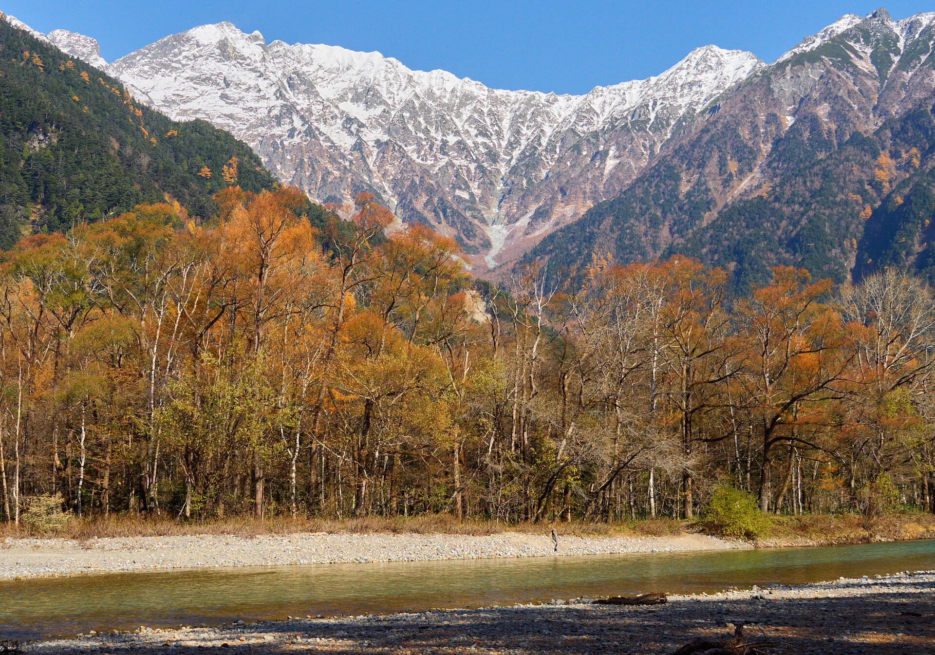
Myojin depends on the time left at Kappa Bridge
The walking map puts Myojin about 50 minutes from Kappa Bridge by one bank and 60 by the other. The return already approaches two hours on foot, before time at Myojin Pond, the shrine, lunch or slower sections.
A sensible personal threshold is roughly three free hours at Kappa Bridge after subtracting your return-bus margin. It leaves a visit rather than a hurried out-and-back. The figure is a planning allowance built from mapped walking times, not a transport rule. The central walk is timed in the Matsumoto day-trip guide.
Check the conditions that can remove that spare time:
Is the return bus booked, or are you relying on spare seats?
Must a bag be back in your hands before the counter closes at 17:00?
Has rain, wind or a colder trail changed the likely return pace?
Can the least comfortable walker complete another two-hour circuit easily?
If the bus, weather, bag or slowest walker leaves little margin, end the walk in the central valley. The Taisho-to-Kappa route already covers the distinctive first-visit scenery.
Tokusawa changes the purpose of the day
Myojin to Tokusawa adds about another hour in each direction. From Kappa Bridge, that makes a Tokusawa round trip roughly four hours of walking before food, photographs or the southern Taisho Pond corridor enter the plan. Compare another elevation-sensitive mountain route in Tateyama autumn leaves.
Strong walkers can make Tokusawa the autumn objective by arriving early and giving it the day. It should not be a casual extension after completing Taisho Pond and Myojin. A night in the valley makes more sense when the northern route, rather than the central sights, is what you came for. For the Takayama side of a longer trip, use Takayama autumn walking.
A reservation is the safest basis for the 2026 bus day
The 2026 Matsumoto and Shin-Shimashima route operates from April 17 to November 15 under reservation-priority boarding. Reserved passengers board first; others are accepted in order only when seats are available. A timetable shows a service, not an available seat.
English visitor guidance uses firmer reservation language and describes same-day tickets only where capacity remains. The practical reading is the same for a foliage weekend: reserve the mountain-bus sections you need and use walk-up travel only as a fallback with time to spare.
If a preferred service is full, check another departure and shorten the planned walk accordingly. Do not use the existence of possible walk-up seats to promise a specific return after a long hike.
The Matsumoto–Shin-Shimashima rail connection is Alpico Railway, not JR. Its boarding does not follow the mountain bus seat-priority system, so keep the train and bus portions distinct when booking. The railway versus bus distinction also matters in the Tateyama traverse plan.
A stored suitcase can end the walking day before the bus does
The Kamikochi Bus Terminal baggage counter lists 06:00–17:00 opening during the April 17–November 15 season. Daily indicative storage charges range from ¥350 for a small bag to ¥600 for an extra-large one. The available racks may fill in busy periods. counter hours and rates
A later bus does not extend access to a bag left behind the counter. Collect it before 17:00, then use any remaining time nearby instead of setting out on another distant trail.
This particularly affects a Takayama or Hirayu arrival followed by a Matsumoto departure. Send a main case around the park, leave it with a lodging property, or build the walking route around the 17:00 collection. A one-way itinerary is only smooth when the luggage follows a workable path. A west-to-east routing appears in the Chubu five-day itinerary.
Choose the gateway from the wider route
Matsumoto is the east-side approach for Tokyo, Nagano and many central-Japan rail itineraries. Takayama and Okuhida travellers usually enter from the west through Hirayu. The two towns are different entrances rather than interchangeable hotel districts. The western gateway can be built into Takayama, Shirakawa-go and Kanazawa without a car.
A west-to-east crossing can begin at Hirayu, pass through Kamikochi and finish in Matsumoto, avoiding a return along the same road. The reverse is possible. Decide where to sleep after the walk, then solve the suitcase before taking the first mountain bus. For the hotel move decision, compare Takayama day trip or overnight.
For a bag that should bypass the walking day, use Japan luggage-forwarding guide
Drivers must still change vehicles outside the valley
Private cars are barred from Kamikochi throughout the year. Approaching from Matsumoto, park at Sawando and continue by shuttle or taxi. Budget ¥800 per day for a normal car and ¥1,600 one way or ¥3,000 return per adult on the shuttle to the Bus Terminal. The parking area has roughly 2,000 spaces. Services are described as about 15–20 minutes apart, with roughly 25 minutes aboard. Sawando access rates facility-page comparison For a car-based autumn day elsewhere, see Korankei from Nagoya.
On the Takayama side, Hirayu/Akandana has around 850 spaces; the listed standard-car charge is ¥600 per 24 hours. A private vehicle cannot continue into the protected valley from that gateway either. Akandana parking
Autumn weekends can fill Sawando parking by 08:00–09:00. A rental car may help with the broader Alps trip, but it does not remove the shuttle, an early start or the risk of a queue at the park boundary. Another mountain access choice is in Tateyama’s summer route.
An overnight should buy hours you can actually use
A day trip covers the Taisho Pond–Kappa Bridge route when the forecast is usable and a return seat is secured. A room inside Kamikochi is more valuable for dawn light or mist, a quieter evening, a long Myojin/Tokusawa day, or a second chance after poor weather. A route that preserves two weather chances is in the ten-day autumn itinerary.
Compare those benefits with the room price, check-in and meal times. Arriving late and leaving soon after breakfast may add a hotel move without adding meaningful time outdoors. For western-side lodging, compare Takayama autumn hotels.
↔ Scroll table left or right
Stay pattern | Best use | Weak fit |
Matsumoto before a day trip | An early bus without the cost of a valley room | Dawn or evening photographs inside Kamikochi |
Near Kappa Bridge | Central first visit and easy terminal access with two light windows | A trip spent away from the room almost the entire time |
Taisho or Tashiro side | Morning mist and a quiet riverside start | A northern walking objective beyond Myojin |
Myojin or Tokusawa | A long walk is the main purpose and the group travels light | Easy luggage handling, flexible meals or a quick onward departure |
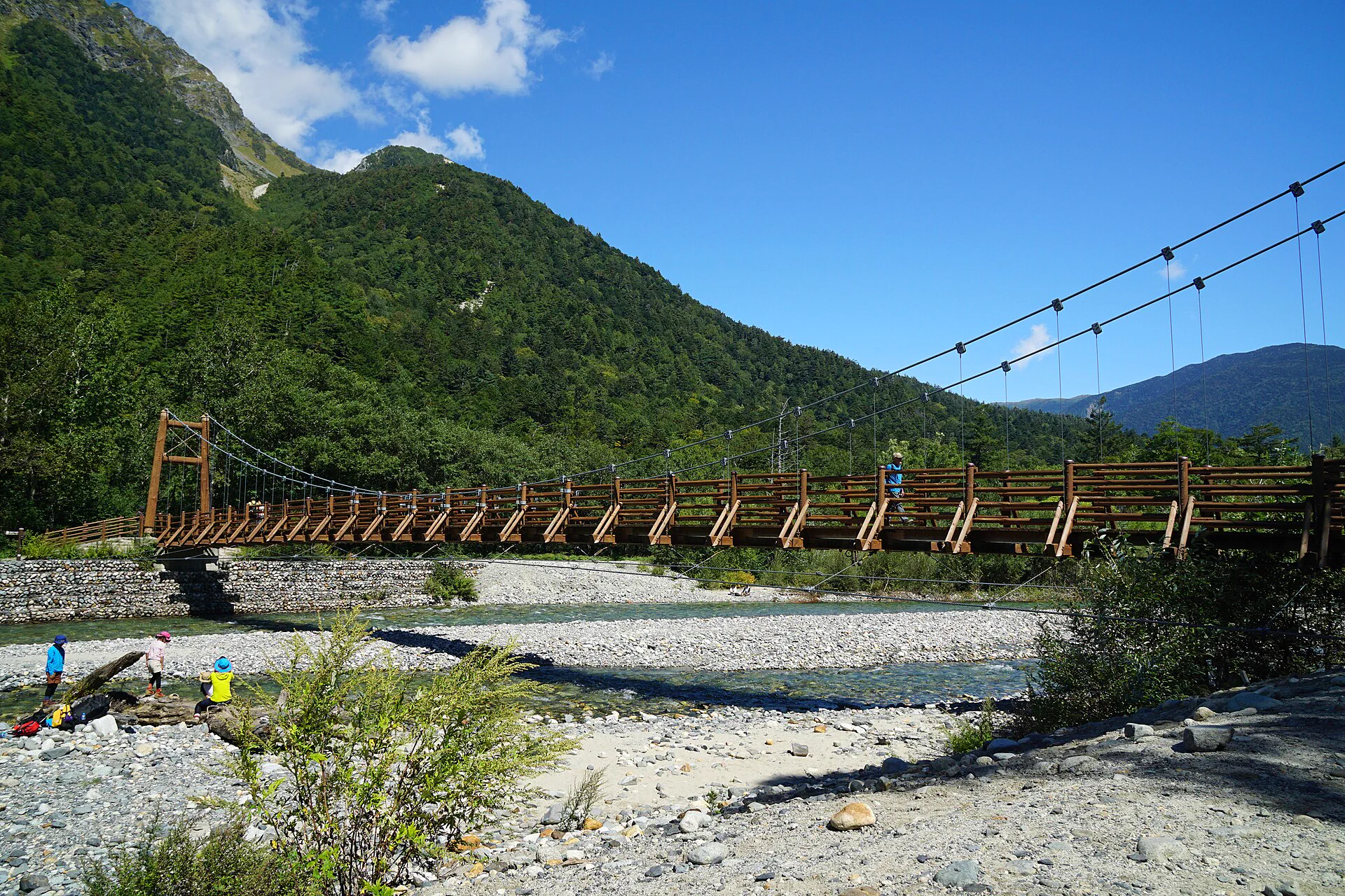
Cold and wet conditions call for a shorter map
Kamikochi sits around 1,500 metres above sea level. Its autumn mornings can be much colder than Matsumoto or Kyoto; rain, wet leaves and early snow change walking speed and footing. A poor forecast may justify a central stroll rather than automatically losing the entire visit. The broader clothing breakdown is in the autumn layers guide.
Cold and clear: add layers and allow a slower morning without necessarily cutting the route.
Persistent rain: keep the central Kappa Bridge and Tashiro sections, which can be shortened.
Wind after strong colour: expect leaf fall and look to the river, mountains and remaining larch rather than one maple tree.
Snow, ice or a closure notice: follow the trail restriction and do not hurry across unsafe surfaces.
A day with faded maples can still have yellow larches, river reflections, wetland colour or fresh snow above the valley. Judge the scenery visible on your date and choose a route safe for the ground conditions. For the next foliage stage nearby, see Shirakawa-go autumn leaves.
How to put the colour and route together
If this is a first autumn visit, choose a date for the colour layer you most want, secure the bus, then walk from Taisho Pond toward Kappa Bridge when conditions permit. Decide on Myojin only after seeing the time and the group’s pace at the bridge. Tokusawa belongs to a longer walking day, ideally with a deliberate early start or overnight.
Stay in Matsumoto or Hirayu when the central route is the goal and an early bus is workable. Spend a night in the valley when it opens dawn, evening or a second weather window you intend to use. Anyone storing a suitcase at the terminal must plan around 17:00 regardless of the return bus time. The west gateway is examined in the Takayama overnight decision.
Kamikochi and its gateways for a night
Compare stays for the Kamikochi and Matsumoto route
Walks and neighbouring autumn routes
Before leaving for the valley
Keep the booked mountain-bus departure, a walking map and the 17:00 baggage deadline together. Reassess the intended path after wind, rain or early snow; a closed trail calls for a shorter open route. Matsumoto-side buses English bus timetable autumn colour sequence walking map baggage counter car access
Related guides: Hakodate and Onuma Autumn Leaves: Late Foliage Timing, Transport and Where to Stay · Kankakei Gorge Autumn Leaves Guide: Ferries, Buses, Ropeway and Where to Stay · Where to Stay for Tohoku Autumn Leaves: Sendai, Morioka, Aomori and Hachinohe · 5-Day Hokkaido Autumn Leaves Itinerary: Driving, Public Transport and Where to Stay · 10-Day Japan Autumn Leaves Itinerary: Regional Routes, Transport and Where to Stay · Asahidake vs Kurodake Autumn Leaves: Ropeways, Hiking and Where to Stay · Where to Stay at Lake Kawaguchi for Autumn Leaves: Station, North Shore or Fuji-Yoshida? · Nikko vs Okunikko in Autumn: Day Trip, Overnight and Where to Stay · Iya Valley Autumn Leaves Guide: Driving, Buses, Vine Bridges, Onsen and Hotels · Kyushu Autumn Leaves: Timing Map from Fukuoka to Yufuin, Unzen and Takachiho
More regional autumn planning
Shirakawa-go Autumn Leaves: Buses, Viewpoint, Luggage and Hotels
Japan Autumn Leaves Photography Guide: Timing, Weather, Lenses and Crowd Strategy
Hachimantai Autumn Leaves Guide: Scenic Drives, Buses, Onsen and Road Closures
Where to Stay for Oirase Autumn Leaves: Gorge, Lake Towada, Hachinohe or Aomori
Where to Stay in Kyoto for Autumn Leaves: Kyoto Station, Kawaramachi, Gion or Osaka?