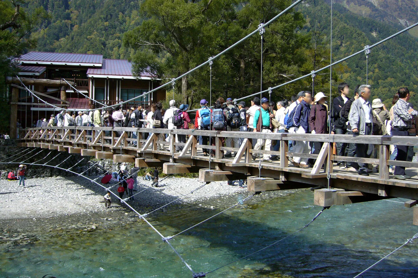
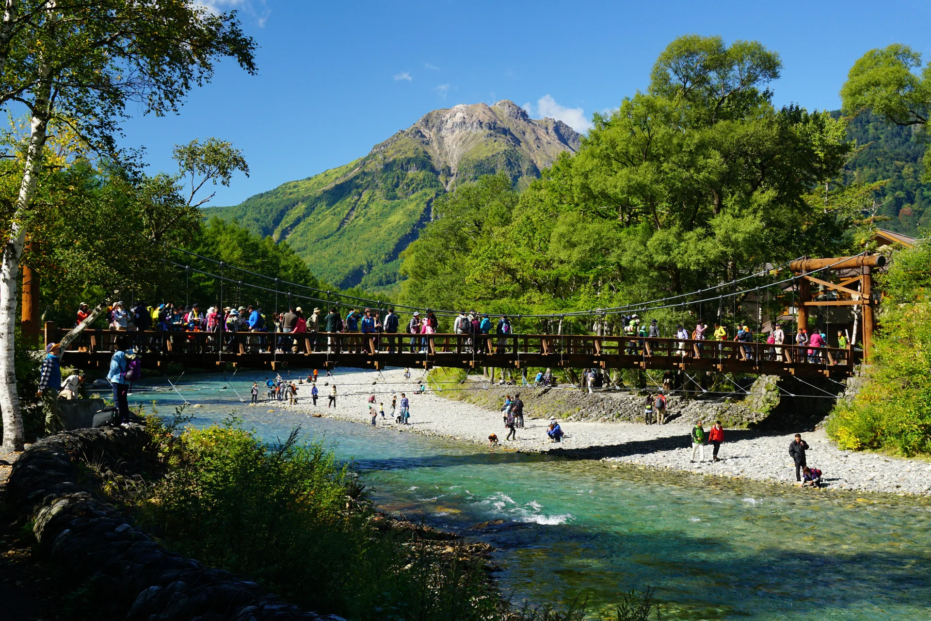
A first Kamikochi visit is easier to plan backward from the bus home. From Matsumoto, a rewarding one-way walk begins at Taisho Pond, passes Tashiro Pond and finishes at Kappa Bridge and the Bus Terminal. If you reach the bridge with about three usable hours before your own return margin, Myojin becomes an option. Tokusawa is much farther: the walk from Kappa Bridge takes more than two hours in each direction before any stops, so it needs a day built around walking. A five-day regional route can incorporate the same crossing: Chubu itinerary.
For the 2026 season, buses between Matsumoto or Shin-Shimashima and Kamikochi use a reservation-priority system. A seat can be taken without an advance booking when space remains, but the timetable alone does not guarantee that space. Securing the journey out is especially valuable when a late bus or a hotel move leaves little room to recover from a full service.
↔ Scroll table left or right
Time or constraint | Walk to build around | Leave out |
2–3 usable hours | Taisho Pond via Tashiro Pond to Kappa Bridge and terminal | Myojin; keep meal and return time |
4–6 usable hours | Use the pond-to-bridge route first; reassess at Kappa | Myojin if weather or energy is poor |
6–8+ hours and strong walkers | Core route plus Myojin when the return is secure | Tokusawa as an afterthought |
Young child or limited mobility | Terminal, Kappa Bridge and a short Tashiro loop | Using Myojin as the test of a complete visit |
Bag held at the terminal | Plan to retrieve it before 17:00 | Using the 17:55 bus to justify more walking |
Tokusawa, dawn or two weather chances | Consider sleeping in the valley | Fitting overnight goals into a short day trip |
The bus home may not be your earliest deadline
The Matsumoto-side 2026 bus season is scheduled from April 17 to November 15. Kamikochi departures toward Shin-Shimashima continue through the day; the last listed bus leaves at 17:55. A booked passenger boards ahead of a walk-up passenger, who can travel only if a seat is still open. 2026 departures
Choose the return while the walking plan is still flexible. Allowing about 30–45 minutes back near the terminal before departure is a useful personal margin, not a bus-company rule. With children, rain, Obon or autumn foliage crowds, give that margin more room. A long route that ends at the terminal just as the bus is leaving was too long. For foliage-season timing, see Kamikochi autumn routes.
Anyone using the Bus Terminal baggage counter has a separate clock: its stated hours are 06:00–17:00. The 17:55 departure is irrelevant to the suitcase if it is still behind a counter that has closed. On a transfer day, plan the route so the bag can be collected first, with walking time measured against 17:00 rather than the final bus. Baggage counter hours
Three return-day constraints to check
With no stored bag and a reserved late bus, the bus departure sets the final edge.
With a suitcase at the terminal, collect it before 17:00 even if the bus leaves later.
Without a bus booking, allow for the possibility that the desired service has no spare seat.
What reservation priority means in practice
ALPICO puts reserved travellers first on this route. An unreserved traveller may board in arrival order if the bus has spare seats, while the English service page warns that same-day options can fill. Both statements matter: walk-up travel is possible, but a specific departure is not secure until booked.
If the mountain day is the centrepiece of a short trip, reserve the required bus section. Someone with a looser schedule may still find a same-day seat, but should keep a route that can shrink if the outbound or return journey changes. Neither blanket “booking required” advice nor casual show-up advice reflects the service as published.
Matsumoto Bus Terminal has direct National Park Liner departures listed for 05:30 and, later, 10:15; these popular buses often sell out. Alternatively, ride the Alpico railway to Shin-Shimashima and change to the valley bus. There is no seat-reservation requirement on the rail leg.
A September 2026 rule affects intermediate return stops
A rule introduced on September 1, 2026 makes the Kamikochi-to-Sawando Ohashi stretch pickup-only on buses bound for Shin-Shimashima. Travellers can book an outward journey from an intermediate stop along that stretch, or board there without a booking if seats remain. They cannot use that bus to alight at another stop within the restricted corridor. The detail matters if the walk ends outside the main terminal. September boarding rule
A visitor leaving from the Bus Terminal follows the normal departure plan. Someone hoping to board at Taisho Pond or another stop should check that precise stop and service for the travel date. An old timetable screenshot may show a boarding pattern that no longer applies.
The walk should fit the booked transport, including its boarding point. The phrase “last bus” conceals important differences between a departure from Kamikochi Terminal and one from an intermediate stop.
An early arrival gives you choices in the valley
The standard east-side approach is train from Matsumoto to Shin-Shimashima, followed by the Kamikochi bus. ALPICO lists the adult one-way rail fare at ¥710. Ticket machines at Matsumoto for that rail trip take cash rather than IC cards or credit cards, so carry yen before reaching the platforms.
Leaving earlier gives Myojin a chance without making it mandatory. Good visibility and a comfortable walking pace might justify the longer loop. If breakfast is delayed, a trail takes longer than expected or clouds arrive, the first-visit route can still end satisfyingly at Kappa Bridge. If another Alpine Route day is competing for the forecast, compare Tateyama in summer.
A 10:15 direct departure can still work for the pond-to-bridge walk. The later arrival simply makes the core walk the main event and removes pressure to append Myojin because a longer route appeared on a map. Match the scope of the visit to the actual time in Kamikochi.
The Taisho Pond bus stop makes the first walk one-way
The local walking map gives roughly one hour and a quarter to one hour and twenty minutes between Taisho Pond and Kappa Bridge, with the riverbank choice affecting the figure. From the Taisho-ike stop, a route past Tashiro Pond and Tashiro Bridge to the terminal takes around 70 minutes of actual walking. Meals, photographs and rests are additional time. Walking distances
Alighting at Taisho Pond lets the scenery unfold northward: pond, marsh, Tashiro Bridge and the Azusa River before the bus-terminal area. Starting at Kappa Bridge and walking south requires a return over much of the same ground. The bus stop therefore determines whether a short visit feels linear or repetitive.
Bad footing or poor visibility changes the choice. Continue to the terminal when rain is heavy, a walker feels uncertain or someone needs toilets and shelter close by. A shorter Kappa Bridge–Tashiro Bridge circuit can preserve the day without committing the group to the full pond approach.
Repairs following heavy rain in 2024 allowed the riverside section linking Tashiro Marsh with Tashiro Bridge to open again on 18 July 2026. The forest path remained an alternative. Choose between the two using current trail notices, since a historic reopening notice cannot promise an uninterrupted path on your travel day. The seasonal walking version is in Kamikochi autumn leaves.
Kappa Bridge is the decision point for Myojin
The walking map gives roughly 50 minutes from Kappa Bridge to Myojin on the left bank and about 60 on the right. Returning therefore needs close to two hours of movement, before Myojin Pond, the shrine area, a meal or slower sections are added.
Use about three spare hours at Kappa Bridge as a planning threshold for the detour. That is an editorial allowance derived from the mapped walking times and a non-rushed return, not a local access rule. Count it only after subtracting the bus margin and any 17:00 luggage collection deadline.
At the bridge, reassess four things
How much time remains after the group returns to the terminal with its margin?
Must a stored bag be retrieved by the 17:00 closing time?
Could rain or trail conditions slow the return?
Is the least comfortable walker still moving easily?
If time, weather or the slowest walker is already stretched, finish with the Taisho–Kappa route. Reaching the best-known central scenery is a complete first visit; Myojin need not be added to make the day count.
Tokusawa requires a walking-first day
Tokusawa is more than two hours beyond Kappa Bridge in one direction, and Myojin to Tokusawa alone is about an hour. A bridge-to-Tokusawa round trip can consume roughly four to five hours on foot, with no allowance yet for lunch, photographs or the Taisho Pond corridor.
That distance suits a fit visitor arriving early, leaving late and choosing the long walk as the main purpose. It does not slip comfortably into a first visit that also includes Taisho Pond, Kappa Bridge, meals and a calm return. Calling it “one stop beyond Myojin” understates the extra hours. A longer central-Japan route is in the five-day Chubu itinerary.
If Tokusawa is the desired destination, compare an overnight in the valley. A later return bus cannot create daylight or make a rushed long walk more pleasant.
For a half day, shorten the map rather than the breaks
Short central circuits appear on Kamikochi’s walking map. A loop beginning and ending at the Bus Terminal via Kappa Bridge and Tashiro Bridge takes about 55 minutes of movement. The pond-to-bridge route in one direction needs about 75 to 80 minutes. Add time for the pauses that are the point of visiting.
With a late arrival, remove Myojin before removing lunch, toilets, photographs or the return margin. Those are normal parts of a mountain visit, and deleting them turns a small delay into a transport problem.
Even a compact route can take in both ponds, the clear Azusa River and the suspension bridge at Kappa. Distance is a poor scorecard for a place where much of the appeal comes from stopping to look.
The east and west gateways lead to different hotel plans
Matsumoto works naturally for travellers arriving from Tokyo or central Nagano. From there, the rail and bus transfer at Shin-Shimashima is straightforward once the mountain bus seat and departure have been chosen.
Hirayu is the nearer gateway from Takayama and Okuhida. Its Kamikochi buses operate within the April 17–November 15 season and run frequently on the final mountain section. A traveller starting in Takayama normally travels to Hirayu before entering the valley. The wider Takayama decision is set out in Takayama day trip or overnight.
A west-to-east itinerary can enter from Hirayu and leave toward Matsumoto, saving a return over the same road. That only works smoothly if luggage has a solution. Going back to Takayama merely because the previous night was there may add an unnecessary transfer after a long walk. For a multi-city route, consider Takayama, Shirakawa-go and Kanazawa without a car.
Crossing Kamikochi with luggage takes advance thought
Storage at Kamikochi Bus Terminal makes a Hirayu-to-Matsumoto walking day possible without carrying the main bag. The counter operates 06:00–17:00 during the season. Posted one-day prices vary with size, from ¥350 for a small item to ¥600 for an extra-large one; the counter closes before the final Matsumoto-side bus. The same bag problem appears on the Tateyama traverse.
The counter notes that shelves can become full during the busiest summer periods. It is valuable infrastructure, but not a guaranteed empty locker waiting for every arrival. Avoid a plan that fails entirely if the bag cannot be accepted.
On a cross-valley transfer, forwarding a large bag ahead can be more reliable than relying on the terminal counter. Check that the receiving property accepts deliveries and when the bag will arrive. The luggage-forwarding guide explains the trade-off with carrying or storing it; same-day delivery should never be assumed. luggage-forwarding guide If Takayama is the next base, compare Takayama hotel room layouts.
A rental car stops at the edge of the park
The protected valley bars privately driven vehicles, whether owned, rented or motorcycles. Leave a car at Sawando when approaching from Matsumoto, or at Akandana near Hirayu from the Takayama side, then continue by shuttle or taxi. A road trip still has a public-transport final leg. Another car-versus-transit decision is covered in the Tateyama traverse guide.
A car space at Sawando costs ¥800 per day. The detailed parking page describes departures every 15–20 minutes and approximately 25 minutes aboard the shuttle to Kamikochi; the access overview rounds the interval and journey to about 30 minutes each. Allow the longer estimate when setting a walking start. During Golden Week, Obon and autumn-colour weekends, the car parks may fill as early as 08:00–09:00. Sawando parking and shuttle Access overview
The car may simplify the wider Nagano–Gifu trip while leaving a queue and shuttle on the last approach. Treat Kappa Bridge as a mountain-bus destination, not as a quick roadside viewpoint.
Choose a walk the whole group can finish comfortably For a west-side autumn route, see Takayama autumn walking.
Although the valley trails have modest gradients, roots, slick boardwalks, mud and wet foliage still affect footing. The accumulated kilometres can be hard on a child, an older walker or a traveller who has already spent many days on the move. Gentle terrain should not be mistaken for uniformly easy surfaces.
Begin with a mapped 55–80-minute route and lengthen it only if the first section goes well. The risk is not a slow pace; it is committing to Myojin on an easy outbound walk and discovering too late that the return will be hurried. Layer choice matters too; use the autumn clothing guide.
For mixed mobility, a shorter central route is preferable to a march back from Myojin with eyes on the bus clock. The next trip can carry the longer objective.
Weather calls for a smaller route first
Heavy rain disrupted Kamikochi road access temporarily in 2026, and the Taisho-area riverside path reopened only on July 18 after earlier storm repairs. A saved map cannot tell you today’s bus operation or trail status. Read the current notices before the mountain day and again if conditions deteriorate. A separate mountain forecast decision concerns Tateyama foliage by elevation.
A practical weather ladder
In stable weather, walk Taisho Pond to Kappa Bridge and consider Myojin only with time left.
In light rain or low visibility, keep the central route short and reassess at the bridge.
In heavy rain, poor footing or access warnings, remain near the terminal and bridge or move the mountain visit if possible.
When several outdoor days compete for a good forecast, the rainy-day itinerary guide can help decide what to keep, shorten or move. Transport restrictions and trail notices should settle the Kamikochi choice on the day. rainy-day itinerary guide
When does one night earn a hotel move?
Sleeping in Kamikochi can buy dawn at Taisho Pond or Kappa Bridge, a quieter evening after day visitors leave, a relaxed Myojin or Tokusawa walk, a second weather chance, or a natural west-to-east crossing. Those are the benefits to compare against another hotel checkout and bag move. For an autumn overnight farther west, compare Shirakawa-go foliage and hotels.
If the classic pond-to-bridge scenery is enough, an early arrival and a secure return make a day trip efficient. The overnight is less valuable when it mainly replaces a bus ride but does not change what the group can see or do. The broader autumn schedule is in the 14-day foliage itinerary.
Test the hotel move by taking away its dawn, evening and long-walk advantages. If the remaining gain is only a shorter transfer, staying in Matsumoto or on the existing route may be simpler. A walking-focused group or photographer may reach a different conclusion.
A first-visit route with an exit plan
From Matsumoto, take an early service if possible and secure the return that the rest of the itinerary needs. Leave the bus at Taisho Pond for a one-way walk to Kappa Bridge. Only extend to Myojin after checking that about three real hours remain beyond the return margin, the 17:00 bag counter if relevant, the forecast and everyone’s pace.
Make Tokusawa the day’s main walk or give it an overnight. Travellers coming from Takayama should use Hirayu as the western entrance and may leave by Matsumoto if the hotel sequence supports it. Drivers must change to a shuttle or taxi at Sawando or Akandana. Nagoya travellers can start with the Nagoya–Takayama itinerary.
The right route ends with enough time to collect the bag, reach the bus and still have enjoyed the ponds, river and mountains along the way. Extra kilometres only improve the day when they leave room for the return. For a shorter regional foliage trip, use the ten-day autumn routes.
Bus, walking and access details
Current bus timetable and boarding arrangements · English Matsumoto route details · Walking-distance map · Bus Terminal baggage counter · Private-car access · July 2026 Azusa River path reopening. Service and path conditions can change by travel date. 2026 bus timetable English bus route walking map bag counter driving route Azusa path notice
Related guides: Fukuoka Rainy-Day Hotels: Direct Access, Underground Routes and the Last 300 Metres · Yanagawa Day Trip: River Cruise, Eel Rice and the Old Canal Town · Yamadera Autumn Leaves Day Trip: Sendai Trains, 1,015 Steps and Hotels · 14-Day Japan Autumn Leaves Itinerary: Six Routes, Flights and Hotels · 10-Day Japan Autumn Leaves Itinerary: Regional Routes, Transport and Where to Stay · Arashiyama Autumn Leaves Day Trip: Morning, Train and Temples · 5- or 7-Day Kyushu Autumn Leaves Itinerary: Fukuoka, Yufuin, Beppu and Mountain Routes · Tokyo Autumn Leaves Day Trip by Train: Gardens, Ginkgo and Evening Foliage · Okayama Korakuen and Kurashiki Day Trip: Foliage, Lights and Hotels · Kerama Islands Day Trip: Snorkeling, Diving, SUP and Whale Watching
The last bus out of Kamikochi sets the pace of a Matsumoto day trip. If you want an early departure without moving hotels, compare rooms near Matsumoto Station and check the bus stop against the room address before booking.