
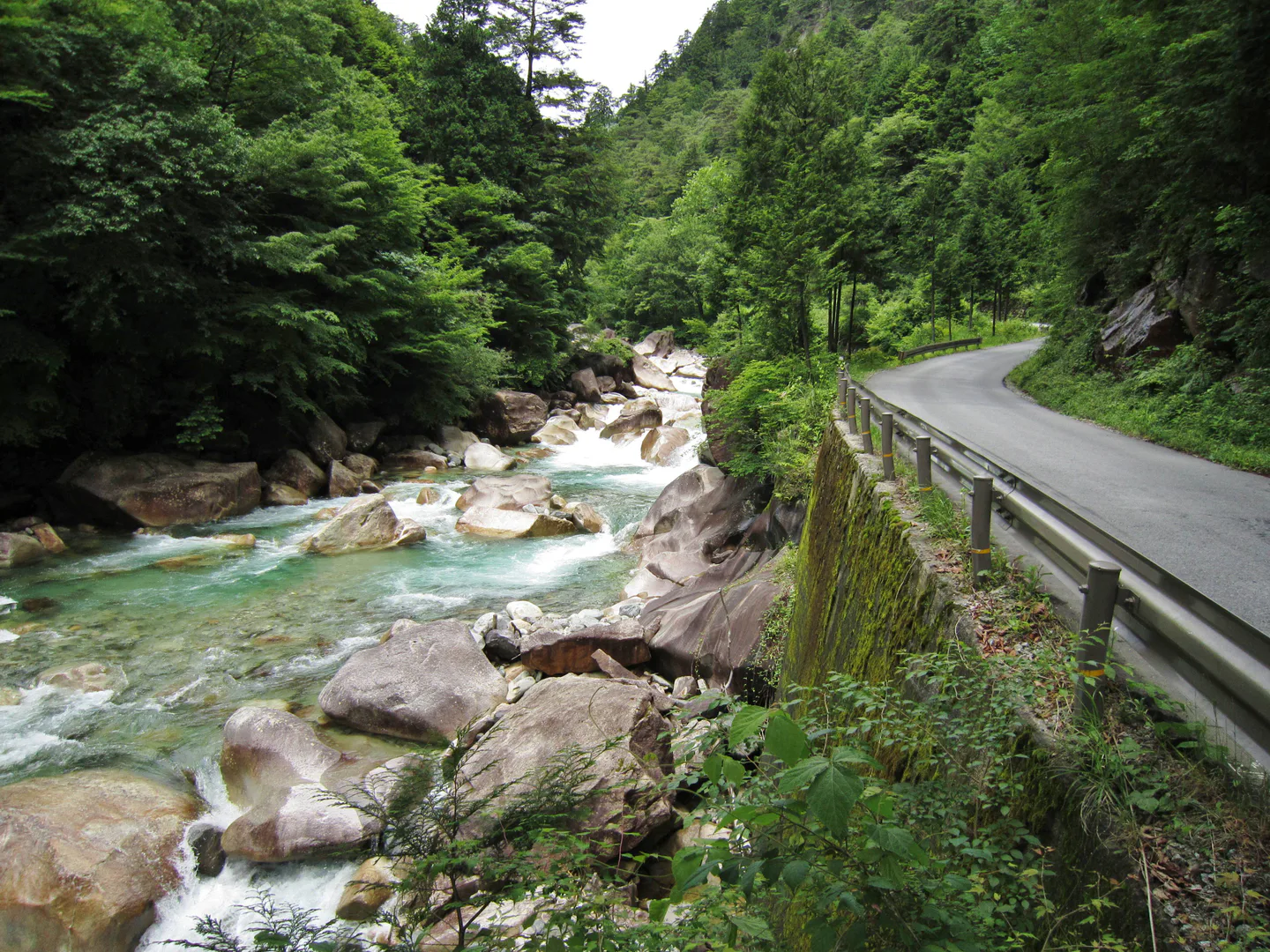
The blue river is deep inside Atera Valley; it is not twenty minutes from Nojiri Station. That twenty-minute figure gets a pedestrian only to the entrance. From there, the signed road and path continue past rock shelves and pools for kilometres. Someone arriving by train can enjoy a short lower-valley visit, but a trip to the upper pools or campground becomes a substantial walking day without a suitable transfer. Choose the furthest point before setting out, then work backwards from the train or shuttle home.
For late October 2026, the summer and September vehicle-control dates are over. The published 2026 shuttle fares and hours below describe that completed season; they are useful for understanding how a future controlled visit may work, not tickets to buy now. Okuwa Village says autumn colour usually comes in late October or early November. The gorge road remains narrow, river and trail hazards remain real, and a future season needs its own access notice. If the weather has brought heavy rain, postpone the water-focused visit even if a photograph from a previous day looks inviting.
↔ Scroll table left or right
| Your approach | Usable visit | Constraint |
|---|---|---|
| Nojiri Station on foot | Lower pools with a chosen turn-back point | The twenty-minute station walk ends at the entrance, not the upper gorge. |
| Car on a controlled date | Park outside and use that season's shuttle or e-bike when offered | Private vehicle entry and the final transfer set the day. |
| Car outside controls | More choice of stopping point | Road width, shared pedestrian space and legal parking still limit movement. |
| Family or less confident walker | Short viewpoint circuit and optional path section | Unpaved trail, metal stairs and long approach should be treated separately. |
| After heavy rain | Move the nature day elsewhere | Water can rise and rocks can fall even when the entrance looks calm. |
The walk begins where the station shortcut ends
Okuwa Village puts JR Nojiri Station about 1.5 kilometres and twenty minutes' walk from the gorge entrance. Its walking guide then allows about two hours one way for the 6.3-kilometre entrance-to-campground route. Neither number includes a long photo stop, lunch or the walk back. This is the central planning distinction for a visitor without a car. A place that is accessible by rail can still demand a full day on foot. The luggage-forwarding decision is especially relevant if Atera is inserted between hotels.
The route offers several natural turn-back choices. The village's detailed sequence puts Senjojiki Rock roughly 25 minutes beyond the entrance, Tanuki-ga-fuchi at 45, Inugaeri-no-fuchi at 53, Kuma-ga-fuchi at 73 and Ushiga-fuchi at 85. Kippou-no-taki follows at about 97 minutes, with the campground and Bijin-sui area near two hours in. These are one-way estimates on a normal route, not a guarantee for a child, an older companion or a photographer stopping at every pool. Set the return time using the furthest place your group can reach comfortably.
↔ Scroll table left or right
| Furthest point | Minimum walk from Nojiri, one way | Out-and-back walking before stops | Use it for |
|---|---|---|---|
| Gorge entrance | 20 minutes | 40 minutes | A short look, not the main blue pools. |
| Senjojiki Rock | 45 minutes | 1 hour 30 minutes | A lower-valley rail visit. |
| Tanuki-ga-fuchi | 1 hour 5 minutes | 2 hours 10 minutes | A defined walk with a return train in mind. |
| Inugaeri-no-fuchi | 1 hour 13 minutes | 2 hours 26 minutes | A longer pool-focused outing. |
| Kuma-ga-fuchi | 1 hour 33 minutes | 3 hours 6 minutes | A substantial walking commitment. |
| Ushiga-fuchi | 1 hour 45 minutes | 3 hours 30 minutes | A day that needs a firm turnaround. |
| Campground | 2 hours 20 minutes | 4 hours 40 minutes | A full approach before meals, photos or a side trail. |
The arithmetic doubles the village's baseline outward time and adds the station approach; it does not price in a missed train, wet footing or a rest. A walker who reaches an attractive pool later than expected should turn earlier, rather than treating the original destination as a promise. Save the return train before mobile coverage disappears. If the path is merely one stop on a larger Chubu journey, the five-day Chubu route helps show what a full gorge day would displace.
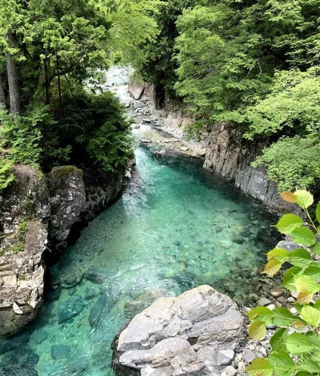
The first image looks down into a narrow clear pool between rock walls. It shows why the river draws people farther into the gorge; its transparency is no evidence that the water is shallow enough to enter safely.
The 2026 vehicle season is now a record, not an open booking window
Okuwa's 2026 notices controlled ordinary vehicle entry all day from July 18 to September 6, on September 12–13 and again September 19–23. The annual schedule also included the late-April to early-May holiday period. These dates have passed as of 24 October 2026. The next year's restriction days, exemptions, parking and transfer operations must be confirmed when the village publishes them. Do not treat a closed summer access system as a currently running attraction.
During the completed 2026 controls, the transfer linked Forrespa Kiso with the Shimaki Akahiko monument parking area in the valley. The village's September update described about one or two buses per hour, with a full vehicle requiring passengers to wait for the next. Earlier planning copy said one to three; the later village notice is the better description of the finished season. The displayed operating window was 09:00–16:00. A visitor should always plan the return before spending the afternoon upstream, because a shuttle end time cannot be replaced by a road map.
The 2026 fares were ¥1,500 return or ¥800 one way per seat, with no child fare. Standard-car parking cost ¥1,000; a motorcycle cost ¥500. Electric-assist bicycle rental was listed at ¥1,000 or ¥1,500 per hour depending on type. Those are historical yen amounts, not a quote for the next season. A car with two return shuttle seats would have cost ¥4,000 before food; four seats plus that parking would have cost ¥7,000. The river itself has no equivalent admission charge, but the access method changes the family budget. For a future trip, compare the newly posted yen prices and your payment currency when that season opens.
Even beyond a controlled period, driving is not effortless. Vehicles, walkers and cyclists share a tight road where passing can be difficult. Pull into a suitable passing place when facing traffic, use designated parking and keep private land and the narrow roadside clear. A car lets a party choose its point of entry on a day when permitted; it does not make every river bend a safe place to stop. For a wider trip, compare the transport decision with a rail-and-bus mountain route or another rural valley where driving changes access.
A road walk and the forest trail ask different things of you
The dedicated nature trail links two suspension bridges. The village estimates around 45 minutes for its loop, with Rokudan-no-taki adding roughly 15 minutes. Those minutes are separate from the station-to-entrance and entrance-to-pool approach. The trail is unpaved, climbs and descends, and has metal stairs that become slippery in rain. A family can reasonably look at the pools from the road and leave the loop out; another group may prefer the forest walk to a longer road approach. The difference is physical effort, not a ranking of which visitor is doing Atera correctly.
Choose shoes with grip for wet stone and uneven ground, and use a day bag that leaves hands free. A companion who is comfortable on a paved road may still dislike the metal stairs or a suspension bridge. Discuss the trail before departing rather than discovering that one person's only acceptable route is several kilometres behind the group. On a day of uncertain conditions, Kamikochi's route choices illustrate another way to select a nature walk by distance and terrain, while the autumn clothing guide helps separate a damp gorge from a city stroll.
There is little reason to add the waterfall spur because the day's access took effort. Decide whether the additional stairs, path condition and time still fit after reaching the trail junction. A visitor on a firm return train should put that departure ahead of a final sight. A walker who has arranged a local overnight can take a slower route, but still needs daylight, weather and an understood exit. The station's convenient distance from the entrance does not change the trail's mountain character.
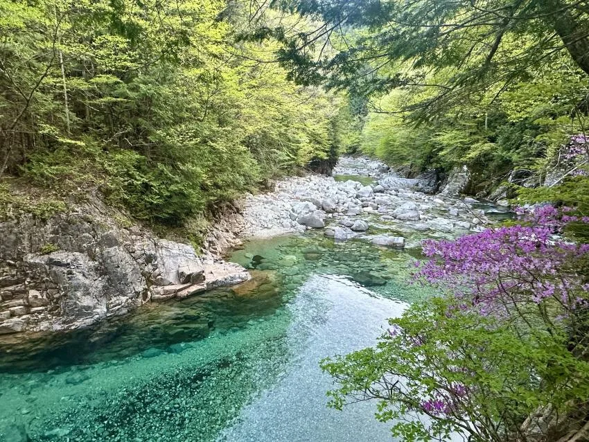
The second photograph shows blue-green water over pale rocks, with vegetation and purple flowers along the bank. Neither a calm surface in the image nor the clarity of the river establishes its depth or current on a later day.
The cold river is a viewpoint, not a managed pool
Okuwa Village warns that the Atera River remains very cold even in summer. Its noon averages were about 13°C in July and 16°C in August. Clear water can make a deep section appear shallow; swift water, unstable rocks and an unexpected drop add risk. The gorge is not equipped as a supervised swimming facility. Keep the visit centered on walking and viewing. If anyone chooses to approach the edge, the absence of mobile service in much of the valley makes independent rescue harder, not easier.
The village prohibits jumping from a bridge or rock and entering the river after drinking alcohol. It also asks visitors to consider bears in this natural habitat, use appropriate precautions and stay on permitted roads or paths. Avoid collecting or damaging plants, take rubbish out, and never block a passing place with a vehicle. The conservation rules prohibit fires, barbecues, fireworks and littering. Amendments effective 17 June 2026 also bar day-and-night nuisance noise and camping in specified entrance and forest areas outside the designated campground; breaches can attract a fine of up to ¥50,000. A roadside tent is not a shortcut to an early photograph.
Rain changes more than the colour of the water. River level and rockfall risk can increase after a downpour, and rain upstream matters even if the road entrance is dry. The metal trail steps are another reason to shorten or cancel a wet-weather route. If rain is light and local guidance allows a visit, a short road-side viewing plan may be preferable to the trail. After heavy rain, in an upstream warning or during a severe-weather pattern, move the gorge day. The rain response guide can help rearrange a broader holiday, while an alpine autumn walk demands its own local weather decision.
How long the valley takes depends on the approach
↔ Scroll table left or right
| Visit shape | Time judgment | Keep or change? |
|---|---|---|
| Station walk to a lower pool and back | A practical shorter rail outing with a firm turn-back point. | Keep if the train times allow rest and photographs. |
| Transfer into the valley plus one trail section | A plausible half-day on a future date when that transfer operates. | Keep a margin before the final return. |
| Nojiri walk to upper pools or campground | Several hours of walking before a trail or meal. | Treat it as a full nature day or choose a nearer goal. |
| Heavy rain or recent upstream downpour | Do not calculate a scenic time target. | Replace the outing because water and rockfall risks dominate. |
A half-day works when a transport choice removes most of the long approach and the visitor selects one or two pools or a defined trail section. A full day is reasonable when the gorge itself is the main Kiso experience, several pools and slow photography matter, and there is no timed appointment immediately after. A rail traveller walking deep into the valley should not call the same route a half-day merely because the list of attractions is short. The access walk is the activity. For a wider trip, a Nakasendo overnight or Takayama autumn base can be compared with the time and hotel move Atera would require.
Car-free visitors should save their Nojiri return train and the route before entering the signal-poor gorge. Okuwa lists a village bus on the Nojiri–Suhara line on weekdays, but it is not a frequent tourist shuttle to every pool. Check the date-specific timetable and confirm the stop it actually serves. If there is no workable connection, the plan is a walk or a different mode, not an assumed taxi waiting at the upper valley. Forward a main suitcase only after both hotels confirm acceptance; carry medication, warm layers and the essentials needed during delivery. The luggage guide covers the trade-off.
That last-mile test applies to other mountainous outings but the answers differ by place. Shirakawa-go's bus and viewpoint plan is a comparison for a visitor who wants scenery with a scheduled vehicle and less valley-road walking. Tateyama's route decision is more complex and requires timed non-JR segments, so it should not be added as a casual replacement on the same afternoon. Use those examples to choose the sort of nature day you have time and transport for, not to assume that every blue river or mountain view has the same access.
Stay near the gorge only for a useful morning or evening
An Okuwa or Nojiri night can remove a long early transfer, put a slower gorge day first in the schedule or fit an existing Kiso route. Forespa Kiso Aterasou and the designated Kiso Fureai-no-Sato campground are near the entrance area; the village places the campground roughly a 15-minute walk from the valley. The campground's published 2026 season runs 18 April through 8 November, but that is a dated operating window, not permission to camp elsewhere. Confirm a room or campsite and its check-in conditions before shaping the route around it.
If Atera is only a short detour from a good Kiso base, another hotel change can cost more time than it saves. Count the luggage movement and the next morning's direction. A night is valuable when it lets someone walk unhurriedly, react to weather or continue naturally through the region; it is weak when added solely because the valley looks remote on a map. A Chubu five-day route, Magome–Tsumago lodging and Takayama stay length give nearby alternatives for that night. If Atera is the chosen base, compare Okuwa-area stays for the walking date and check the actual onward route.
A traveller who wants a Kiso night but not necessarily a room at the gorge entrance can use the Kiso Valley base comparison to place the next day's rail and walking start. The same lodging question appears in a more remote form in the Kyushu mountain-road comparison: an overnight helps only when it removes a long transfer or protects a weather window. At Atera, a local room is most useful for a slow gorge walk or an early start, not for making an unsafe river day acceptable.
Seven dimensions to test before making the detour
↔ Scroll table left or right
| Dimension | What the evidence supports | When the answer changes |
|---|---|---|
| Distinctive scenery | Clear blue-green pools, rock walls and forest make the gorge a specific nature goal. | High water or poor visibility can erase the main draw. |
| Fit with route | Nojiri rail access or a Kiso overnight can integrate it into Chubu. | A distant hotel or separate long detour adds a full transfer. |
| Time use | Lower viewpoints can fit a shorter visit. | Upper pools by foot consume hours. |
| Weather resilience | A stable dry day supports the path. | Recent heavy rain is a safety reason to cancel. |
| Operational flexibility | Several turn-back points allow a shorter walk. | Controlled dates and final shuttle narrow the exit. |
| Crowd pressure | A defined route avoids competing for every roadside stop. | Full shuttles and narrow roads create delays. |
| Money use | There is no general admission ticket for viewing the gorge. | Parking, shuttle seats, bike rental and lodging add costs. |
A shorter route on a stable day can give more useful time by the water than a longer route after heavy rain. In October 2026, use the village's autumn condition and road notices for an immediate outing; for a future controlled season, wait for its published dates and transfer rules. Atera works when the chosen pool, physical effort, weather and way home belong to the same plan. If any one of those is missing, the Kamikochi walking routes or another Chubu stop may be the better nature day.
Village access pages
2026 vehicle restrictions, shuttle, parking, e-bike rental, safety and conservation rules · 2026 planned restriction dates · walking times and Nojiri access · walking-trail conditions · access map
Related guides: Lake Biwa Fireworks 2026: Free Viewing, Closures and Otsu Access · Mifuneyama Rakuen Autumn Illumination 2026: Tickets, Access and Hotels · Ginsendai Autumn Leaves Guide: Shuttle Buses, Access Restrictions and Hiking · September Grand Sumo Tokyo 2026 Is Sold Out: Official Resale and No Walk-Ups · Port of Nagoya Public Aquarium 2026: How Long to Spend and When Night Entry Is Worth It · Fukuoka Rainy-Day Hotels: Direct Access, Underground Routes and the Last 300 Metres · Sapporo Odori Beer Garden 2026 Has Ended: Six-Zone Guide and What to Check Next · Akita Kanto Festival 2026 Guide: Dates, Seats, Day Contest and Hotels · Kochi Yosakoi Accessibility 2026: Wheelchair Seats and Low-Walking Plan · Akita Kanto 2026 Is Over: What S, A, B and Free Viewing Taught Us